Day 14: Coquihalla Lakes Lodge – Hope
in Uncategorized
Total Distance Travelled: 60KM
Total Distance Travelled Entire Trip: 673KM
Total Time: 5:16
Moving time: 3:20
It was freezing in the morning when I got up, so I started another small fire to try and warm the place up a bit. There wasn’t much in the way of kindling around, so it was a rather frustrating experience but I did eventually get some heat into the place. Other than for rustic charm, wood heat is quite annoying.
Today I will drop over 1KM vertically, the summit of the Coquihalla pass is 1244m, and the elevation of Hope, BC is 41m. The trail along the Coquihalla is not impressive, trail maintenance is an issue and sometimes the trail simply isn’t worth following. Luckily the first 26KM of my day was on trail though. When the KVR was abandoned, a natural gas pipeline took over much of it’s right of way. The Coquihalla highway itself took the rest. Right at the summit of the pass however, the highway follows a different valley than the old KVR. Trails BC negotiated with the natural gas pipeline and they allowed their maintenance road to be used as part of the trans-Canada trail, and the maintenance road re-used parts of the old KVR. The road is protected by a gate that you have to get your bike and bags over. Motorized vehicles are listed as prohibited, but of course ATVers had still cut a path around the gate.
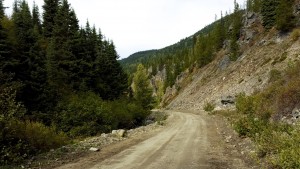
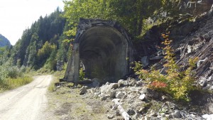
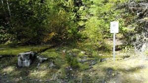
The first kilometer of the trail is right on top of the old KVR:
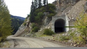
The tunnel along the route had long caved in though, so the road bypassed it. At the start of the trail the river dropped at a sane 1-3%, however as the trail continued the river dropped steeply forcing the old KVR line up on to the side of the valley to maintain a reasonable grade. The pipeline company however didn’t need the 2.2% grade of the old KVR line, so they built a road that followed the river virtually the whole way. This resulted in the road dropping very steeply in places, with my Garmin reporting drops of as much as 9%.
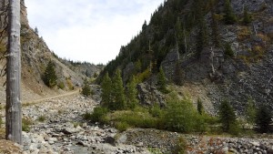
In some places, the valley was extremely narrow:
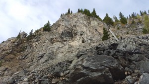
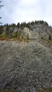
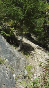
The old railway line could be spotted further down the trail, getting higher and higher up the canyon wall.
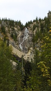
You can see the old bits of metal near the top of the photograph which marks whats left of this section of the right of way. The sides of the canyon were made up of lose rock from landslides, and the canyon walls were extremely steep and imposing. It’s no wonder that they couldn’t keep the line open during the winter, the whole area is avalanche and land slide prone. Further down the trail, Bridal Veil Falls appeared:
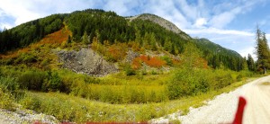
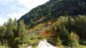
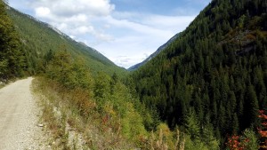
If you look near the bottom of the photograph, you can see a collapsed KVR bridge or snow shed. The whole area was stunningly beautiful, with a narrow canyon surrounded by high mountains. Fall colours were also out in the valley, with the valley being covered with vibrant red.
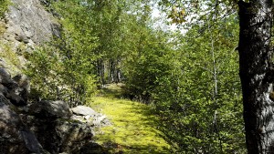
Further down the trail, an original section of the KVR grade was hikeable on foot, marked with a trans-Canada trail sign.
Nature has taken back much of the original right of way, with trees going all over the path. The base of the right of way is now covered in moss.
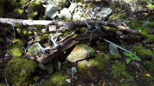
An old part of a telegraph poll was still left sitting on the right of way
After heading back on to the pipeline road, the road again joined the original KVR grade and an old cement snowshed was visible:
A sign also marked the original location of Iago station, however only the foundation of it remained.
It must of been interesting being assigned to small stations such as Iago, these stations weren’t really setup for passenger traffic they housed the maintenance of way staff that maintained the line. In the old days, railroads had people all along the line responsible for small sections of track.
Toward the end of the pipeline road, the valley become extremely narrow with high mountains on either side.
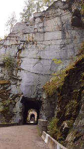
The end of the pipeline road actually had some steep uphill sections with 10% grades, for whatever reason in places the road drops too far down and has to gain elevation to link back up with the Coquihalla highway. I re-joined the highway and was planning on taking the Carolin Mines Road exit for the next park of the trail, however when I took the exit there was no signage for where to go for the Trans-Canada trail. I didn’t have internet access at this location either, and after looking around for a bit I gave up and went back on the highway. It turns out the old right of way is accessible, but only after a steep climb up on Carolin Mines Road. I had also wanted to check out the Ladner Creek trestle as in this video, but again I couldn’t locate the trail when I was on site and I didn’t have internet access to Google it. Some of this poor planning was due to my late arrival last night which didn’t leave me much time to plan my ride on the Coquihalla. The final gem of the KVR that I was able to see was the Othello tunnels, which is now a BC provincial park.
Near Hope the Coquihalla canyon is extremely narrow with high granite rock walls, it was thought pushing a railway through this section would be impossible. However Andrew Mcculloch found a way to get through by blasting 5 tunnels through the canyon each exactly lined up with each other. Impressive engineering for today, never mind the early 19th century.
After visiting the tunnels, it was time to head to my B&B in Hope. This marks the end of the KVR mainline, at Hope the KVR joined up with the CPR mainline. It turned out that the Swiss cyclists I had met earlier in the trip were staying at the Coquihalla Lakes Lodge, and they were headed to Hope as well today. We decided to go out for dinner in Hope, so we headed to a local Korean restaurant.
